Log in
All resources
Create a design
Tools
7,171 Free Images of Atlas Map
national library of poland
maps
vrbivm praecipvarvm mvndi theatrvm qvintvm (1617)
cartography
fondo antiguo
cartografía
libros del siglo xvi
cartografía, mapas | cartography, maps
geografía. descripciones. viajes
mapas, planos, etc.
cartography
maps
cartography
maps
cartography
maps
cartography
maps
cartography
maps
cartography
maps
cartography
maps
cartography
maps
cartography
maps
ribes
maps
old maps of regions of france
pierre françois tardieu
maps by john cary
1799 maps
old maps of rogaland
history of stavanger
maps from university of amsterdam special collections
atlas der neederlanden
maps from university of amsterdam special collections
atlas der neederlanden
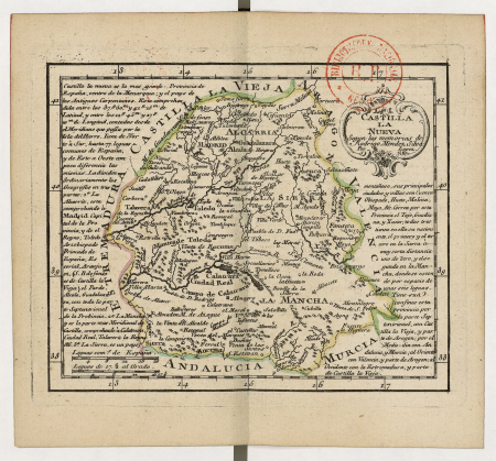
atlas geographico del reyno de españa e islas adjacentes (1757)
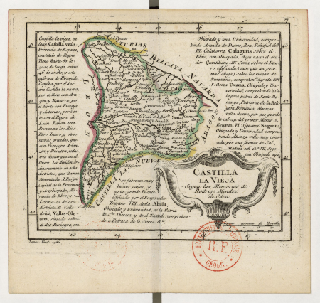
old maps of castilla la vieja
atlas geographico del reyno de españa e islas adjacentes (1757)
old maps of castilla la nueva
1900s maps of arabia
william patten
maps from university of amsterdam special collections
atlas der neederlanden
maps by willem and johannes blaeu
stjärneborg
atlas ou representation du monde universel t. 2 (1633)
old maps of mecklenburg
atlas des anciens plans de paris by imprimerie nationale, 1880 from bhvp
plan de turgot
maps of paris from the david rumsey historical map collection
maps of île-de-france by françois de la guillotière
map of maastricht by willem and johannes blaeu (1649)
history of wyck (maastricht)
maps of borger-odoorn
valthe
gemeente atlas van nederland - gelderland
maps of ede, netherlands
vrbivm praecipvarvm mvndi theatrvm qvintvm (1617)
maps of visegrád by braun & hogenberg
vrbivm praecipvarvm mvndi theatrvm qvintvm (1617)
maps of sarrebourg by braun & hogenberg
vrbivm praecipvarvm mvndi theatrvm qvintvm (1617)
maps of zahara by braun & hogenberg
theatri praecipvarvm totivs mvndi vrbivm : liber sextvs (1618)
maps of čáslav by braun & hogenberg
theatri praecipvarvm totivs mvndi vrbivm : liber sextvs (1618)
maps of dillenburg by braun & hogenberg
theatri praecipvarvm totivs mvndi vrbivm : liber sextvs (1618)
maps of biecz by braun & hogenberg
theatri praecipvarvm totivs mvndi vrbivm : liber sextvs (1618)
maps of poznań by braun & hogenberg
theatri praecipvarvm totivs mvndi vrbivm : liber sextvs (1618)
maps of eisenstadt by braun & hogenberg
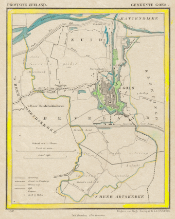
gemeente atlas van nederland - zeeland
old maps of goes
piet schipperus
diepenveen
piet schipperus
beetsterzwaag
vrbivm praecipvarvm mvndi theatrvm qvintvm (1617)
maps of montlhéry by braun & hogenberg
vrbivm praecipvarvm mvndi theatrvm qvintvm (1617)
maps of münstermaifeld by braun & hogenberg
vrbivm praecipvarvm mvndi theatrvm qvintvm (1617)
maps of tours by braun & hogenberg
vrbivm praecipvarvm mvndi theatrvm qvintvm (1617)
maps of tønder by braun & hogenberg
vrbivm praecipvarvm mvndi theatrvm qvintvm (1617)
maps of castelnuovo by braun & hogenberg
vrbivm praecipvarvm mvndi theatrvm qvintvm (1617)
maps of cártama by braun & hogenberg
vrbivm praecipvarvm mvndi theatrvm qvintvm (1617)
maps of acquapendente by braun & hogenberg
vrbivm praecipvarvm mvndi theatrvm qvintvm (1617)
maps of hildesheim by braun & hogenberg
vrbivm praecipvarvm mvndi theatrvm qvintvm (1617)
maps of lyon by braun & hogenberg
vrbivm praecipvarvm mvndi theatrvm qvintvm (1617)
maps of husum by braun & hogenberg
vrbivm praecipvarvm mvndi theatrvm qvintvm (1617)
maps of heide by braun & hogenberg
everett d. graff collection of western americana
george f. cram
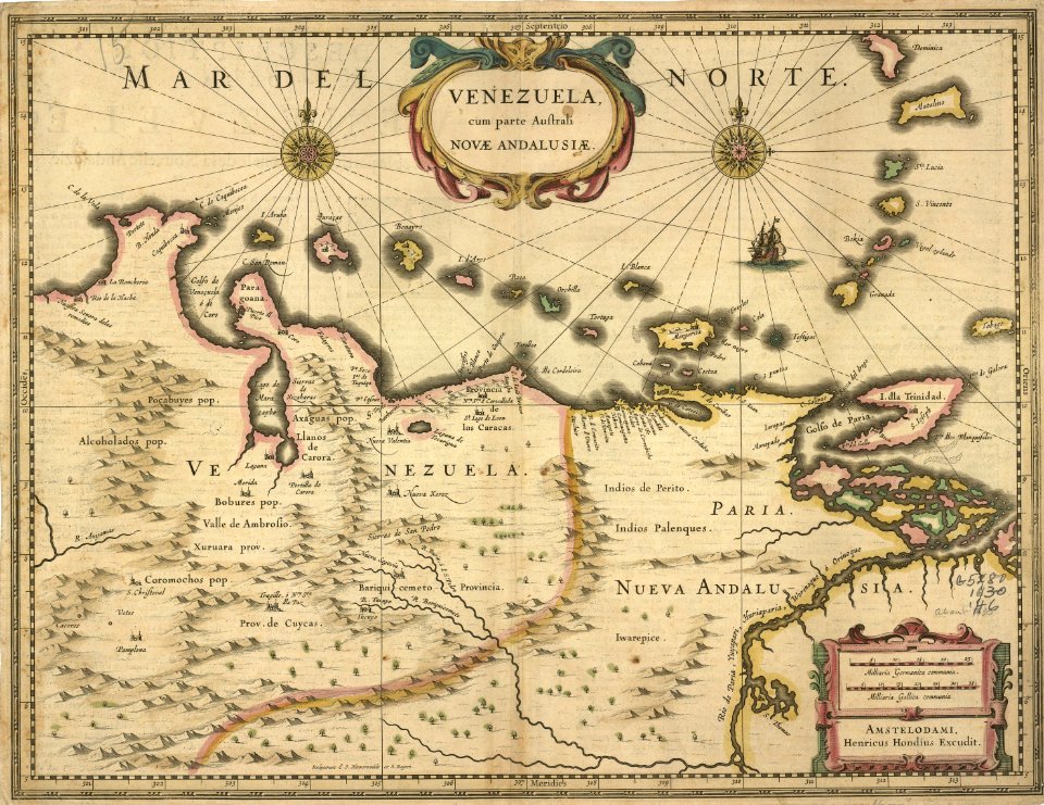
asia noviter delineata
1617 drawings
historical images of macau
asia noviter delineata
atlas sive cosmographicae (gerardus mercator, 4th edition 1613)
maps of east flanders by pieter van der keere
piet schipperus
asia noviter delineata
1617 drawings
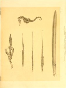
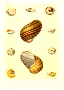
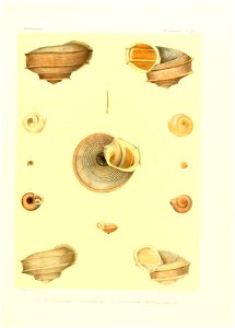
sea life
maps
atlas sive cosmographicae (gerardus mercator, 4th edition 1613)
maps of provence by pierre-jean de bompar
atlas sive cosmographicae (gerardus mercator, 1630)
maps of île-de-france by françois de la guillotière
maps from university of amsterdam special collections
atlas der neederlanden
maps in the library of congress
cartes et plans de l'amerique
map of paris by jouvin de rochefort (boutier 112)
maps of paris by françois de la pointe
coats of arms of illyria
atlas van loon
1803 maps of the caribbean
maps by john cary
background
maps
maps by willem and johannes blaeu
copper engravings
pierre alexander tardieu
pierre gilles chanlaire
historical
history
novi belgii, atlas maior
maps of new england
de praecipvis totivs vniversi vrbibvs, liber secvndvs (1612)
maps of methoni by braun & hogenberg
de praecipvis totivs vniversi vrbibvs, liber secvndvs (1612)
maps of tunis by braun & hogenberg
atlas des anciens plans de paris by imprimerie nationale, 1880 from bhvp
baroque
de praecipvis totivs vniversi vrbibvs, liber secvndvs (1612)
maps of dunkerque by braun & hogenberg
maps of uithuizermeeden
oldenzijl
gemeente atlas van nederland - drenthe
maps of borger-odoorn
gemeente atlas van nederland - drenthe
maps of aa en hunze
gemeente atlas van nederland - south holland
maps of alkemade
atlas des anciens plans de paris by imprimerie nationale, 1880 from bhvp
turgot map of paris, bibliothèque historique de la ville de paris
lepidoptera
maps
atlas des anciens plans de paris by imprimerie nationale, 1880 from bhvp
turgot map of paris, bibliothèque historique de la ville de paris
atlas des anciens plans de paris by imprimerie nationale, 1880 from bhvp
turgot map of paris, bibliothèque historique de la ville de paris
atlas des anciens plans de paris by imprimerie nationale, 1880 from bhvp
turgot map of paris, bibliothèque historique de la ville de paris
lepidoptera
maps
de praecipvis totivs vniversi vrbibvs, liber secvndvs (1575)
maps of tunis by braun & hogenberg
asia noviter delineata
willem blaeu
atlas sive cosmographicae (gerardus mercator, 4th edition 1613)
maps of île-de-france by françois de la guillotière
new york state supreme court 60 centre street
bromley maps of manhattan published in 1916
maps from university of amsterdam special collections
atlas der neederlanden
gemeente atlas van nederland - drenthe
maps of borger-odoorn
map collection of leibniz-institut für länderkunde
1800s maps of the world
charleroi on maps of popp
lodelinsart
1799 maps of the russian empire
maps by john cary
old hemisphere world maps (partner files)
1800s maps of the world
cartography
maps
africa
maps
background
maps
cartography
maps
india
maps
civitates orbis terrarum. urbium praecipuarum totius mundi. liber quartus
maps of malmö by braun & hogenberg
lawrence h. slaughter collection of english maps, charts, globes, books and atlases
1700 maps of the atlantic ocean
lawrence h. slaughter collection of english maps, charts, globes, books and atlases
1700 maps of the atlantic ocean
media from atlas of mutual heritage on dutch east india company
1650s maps of indonesia
4801 - 4900 of 7,171
Next page
/ 72


![The course of the Meuse, with the neighboring countries, dukedoms and counties / by Mr. Sanson ..., [after 1696]](https://cdn.creazilla.com/illustrations/10001348889/the-course-of-the-meuse-with-the-neighboring-countries-dukedoms-and-counties-by-mr-sanson-after-1696-sm.jpg)

![Private carte d'une partie de la Hollande, et du Brabant Hollandois, ou les environs de Breda, Boisleducq, Geertruydenberg, Heusden, Dordrecht, Bommel &c. / I. Condet f. 1748, Johannes Condet, [1748]](https://cdn.creazilla.com/illustrations/10000996562/private-carte-dune-partie-de-la-hollande-et-du-brabant-hollandois-ou-les-environs-de-breda-boisleducq-geertruydenberg-heusden-dordrecht-bommel-c-i-condet-f-1748-johannes-condet-1748-md.jpg)

![Gerardi Mercatoris and I. Hondii Atlas or Representation of the Universal World, and of the Parts of It, Made in Tables and Very Ample Descriptions. [t. 2].](https://cdn.creazilla.com/illustrations/10000490917/gerardi-mercatoris-and-i-hondii-atlas-or-representation-of-the-universal-world-and-of-the-parts-of-it-made-in-tables-and-very-ample-descriptions-t-2-sm.webp)


![Tables of the divisions of the seventeen provinces of the Netherlands / by Mr. Sanson, ordinary geographer to the King, [1692]](https://cdn.creazilla.com/illustrations/10000941957/tables-of-the-divisions-of-the-seventeen-provinces-of-the-netherlands-by-mr-sanson-ordinary-geographer-to-the-king-1692-md.jpg)


![The Lordship of Groningen subdivided into all its jurisdictions / drawn up on the most recent memoirs by Mr. Sanson, [1708]](https://cdn.creazilla.com/illustrations/10001164695/the-lordship-of-groningen-subdivided-into-all-its-jurisdictions-drawn-up-on-the-most-recent-memoirs-by-mr-sanson-1708-md.jpg)